GROUCHO’s CDT Journal VII
Leave a reply


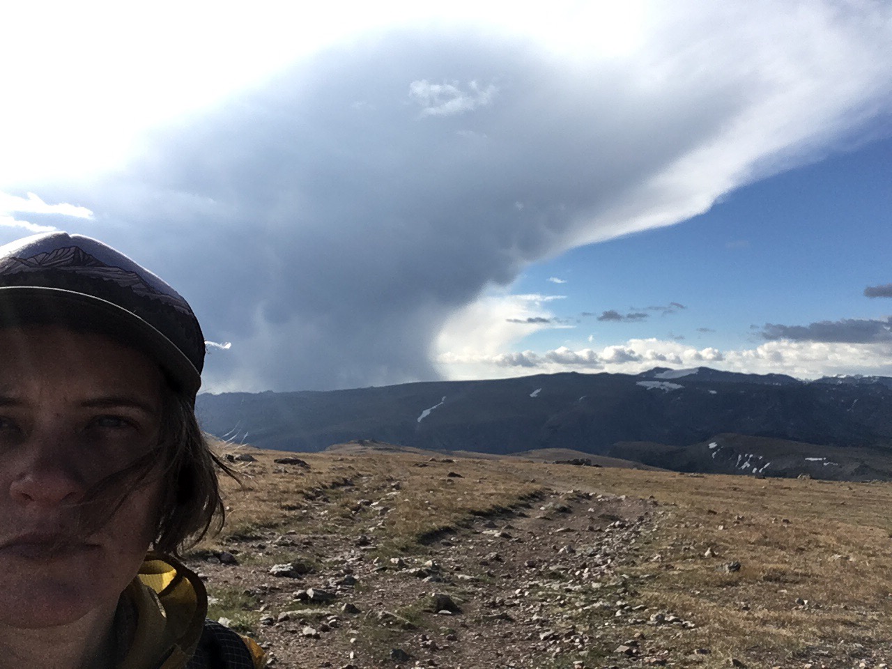
First sunrise in a new state!

More mountains, more meadows, more sun, more stars…

Continuing south thru the verdant passes, tryingvto best the snow

Beating the bears to the berries!


The sunsets are soft & washy just as the days are brite & brutal

Everything in every direction …
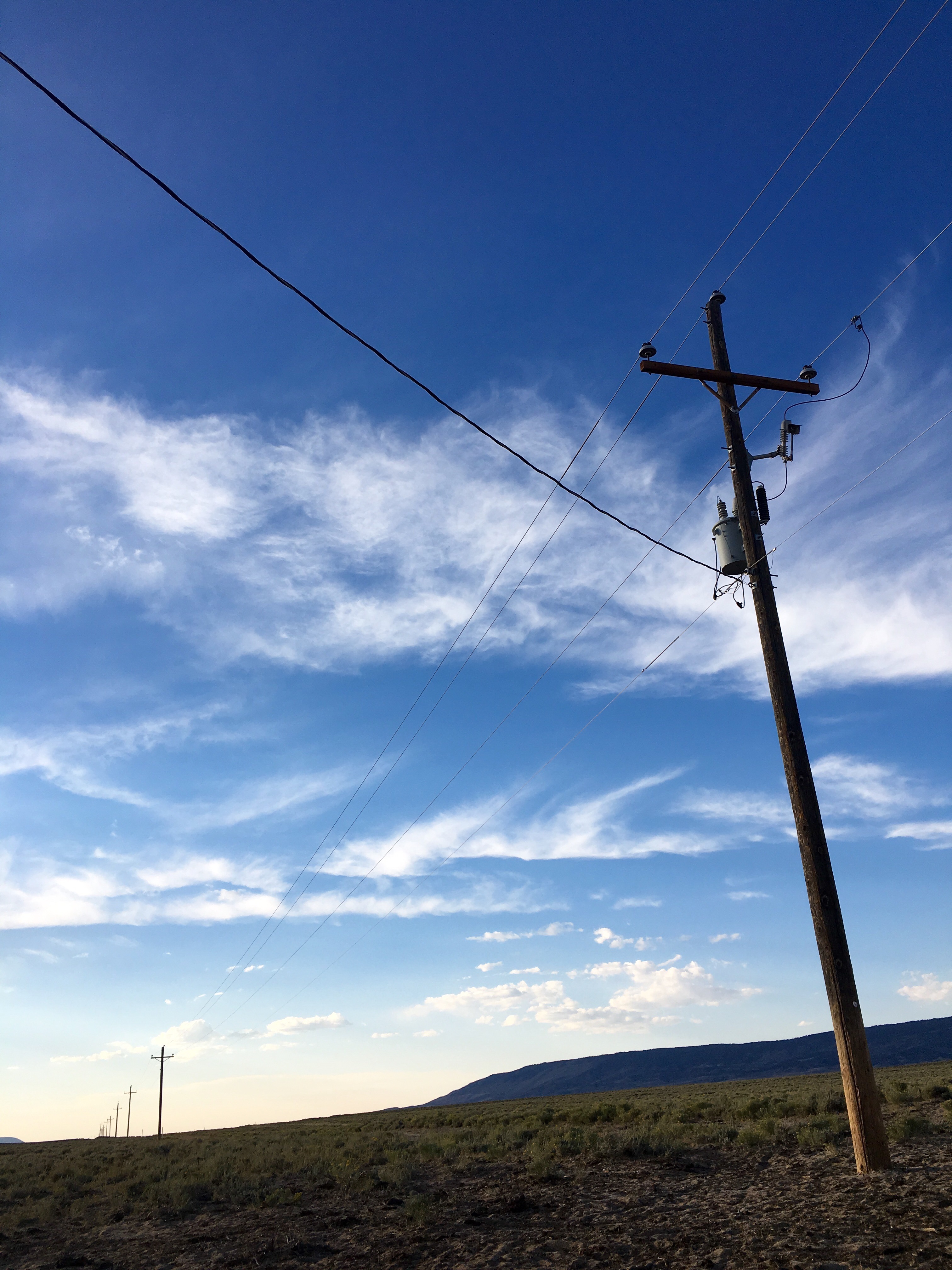
The only sign of human life are traces of powerlines, unused looking roads, and crushed flattened cans rusted breyond recognition
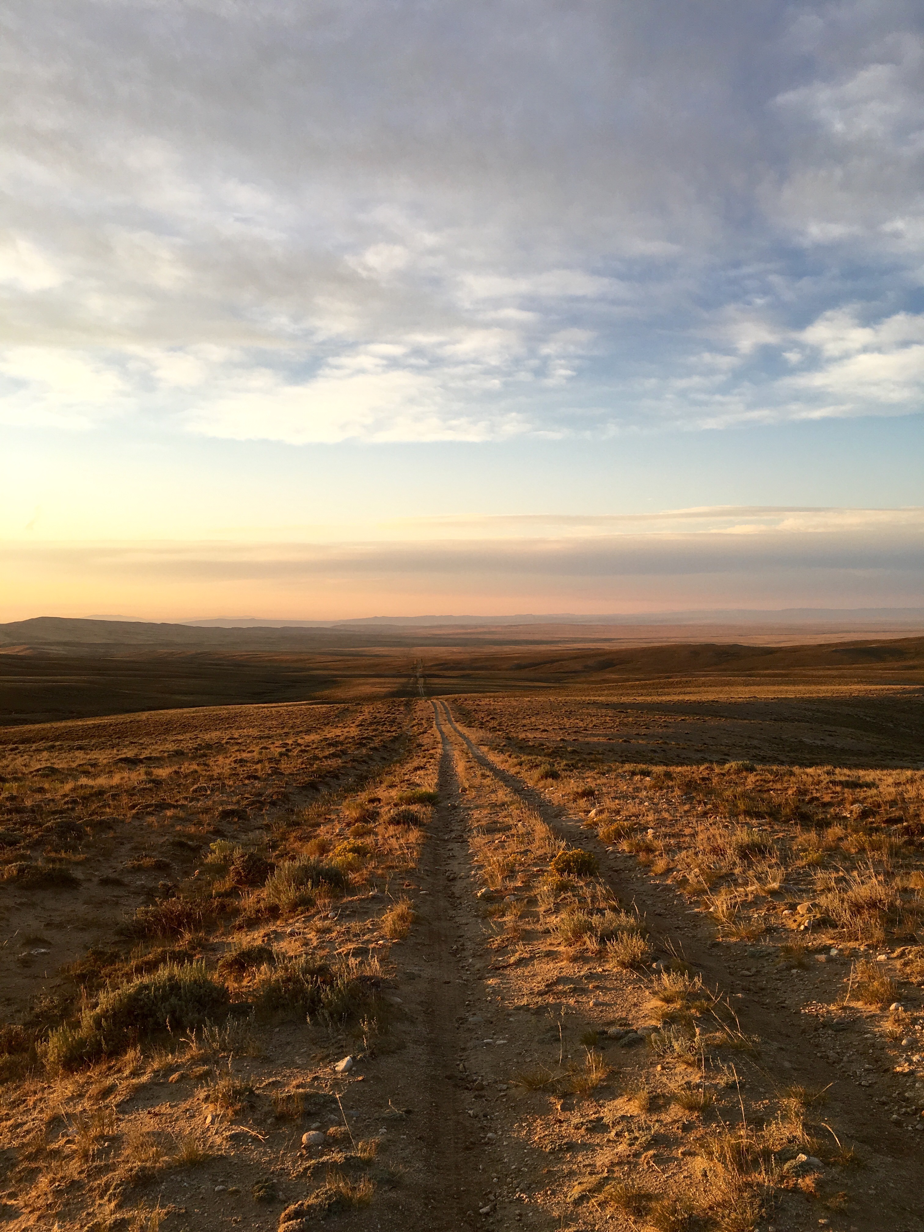
The road is seemingly endless, and the topograpyhy hardly varies during a day of travel

But the sage is blooming…


August 12
24 miles
A Beautiful Day. Finally!
Today is a joy. We relish several hearty breaks, make good miles, and traverse easy but gorgeous terrain of frosty meadows, aspen groves, epic lakes and aqua green rivers.
It’s a popular area with troves of trail runners, day hikers, canoers, and some 7-day section hikers on a similar route as ours.
The green river lives up to its name and we only wish we had extra food so we could camp early along it’s shore.
At the end of the day we turn up the Knapsack Col alternate. Recommended by all NOBO’s this 13 mile alternate replaces as many miles of the CDT. We camp a mile in, saving the climb and “big reveal” of the landscape for tomorrow.

August 13
17.5 miles
There are so many hearty, kind, adventurous Wyomingians out here. We meet several couples who we leapfrog with throughout the day. Social time feels great. I miss people.
But most importantly the views and features along the alternate drop jaws. 100% awesome.
Bouldering becomes the new normal as we scramble up and down mountain cols, skirting glaciers and skipping over glacial melt. The new way of traversing Takes more time, strength and energy tho, and we finish a 12.5 mile section at 5:30 totally depleted having already eaten all our snacks for the day.
Normally we’d simply eat more to perk up but we are on rations now (having taken a low mile day early in this stretch and adding -23mi- when we had to bail from the high route.
I’m very stressed out about this. I’ve never run out of food hiking. I feel so far from our goal – landers, Wyoming. We still have 77+ miles to go and with less energy we go slower still. I feel like a jerk because this is one of the most breath taking places I’ve ever EVER beheld. And all I can think about is getting to town.
We could bail a few places, hiking 11 miles down a side trail to a popular trail head or campground but we’d have to come back the same way which at this point sounds like a drag.
I’m so tired. But stubbornly press forward. Mile after gorgeous difficult mile.

August 14
27 miles
A Good Day. After yesterday’s rigors today feels a bit easier. We wake early, discipline our selves to time our food breaks every 2-3 hours. Miles go more quickly along so many gorgeous lakes.
At one we pre wash our bodies and clothes. Anticipating the 36 mile hitch to town in a few days.
We ran out of coffee yesterday but run into a weathered, handsome gentle soul who becomes our Coffee Angel having packed in too much instant folgers. Groucho pulls a bag out of his collection of slightly used ziplocks and we feel hyped in anticipation of our afternoon coffee break ritual.
In the evening we almost jog across a 4 mile stretch of flat, high, open meadow. Chatting merrily I spy a weird looking dead log by the side of the trail (never mind that there are no trees up here.). As we approach I again wonder why dead logs often look like dead animals. Another two steps and almost imperceptibly the log twitches. Oh crap. “Back up back up back up back up” I stammer as I realize it’s a Badger!! I love badgers but from afar. They have strong jaws and teeth and for their size can be very intimidating if you startle it. This one is pressed as flat in the brush as possible, like a cat stalking prey. I take a great tho shaky video which I will post to YouTube.
We continue till dark, finding refuge under a large tree.

August 15
20 miles
At 3:30am it begins to rain on us. We work swiftly to set up the tarp together. Some things we are really good at now. Like truckers hitch knots. Our gear is just a tiny damp but dry by morning.
I’m a broken record that cannot stop pining for town. But today holds a lot of beautiful, treacherous and rigorous distraction in our Cirque de Towers alternate. A 21 mile path thru 3 steep, Rocky Mountain passes, among jagged peaks and pristine lakes.
A few photos:


Though my mind drifts toward town and my very light food bag, the challenge keeps me very much in the present. Isn’t that what we all aspire to? To be “here”? Not to be with wandering stress, distracted thoughts, worries about the future or regrets about the past. Just to be here now… It’s a gift if only I can accept it. Today I realize that often it takes fear – jumping into the unknown or placing one’s self in precarious and difficult situations – to snap someone back to the present. I’m thankful for this difficult lesson – . In today’s case presented via thunder, rain and hail at 2 mountain passes, steep traverses down narrow, worn down switchbacks, with recent evidence of rockslides, and inclines so steep that my toned calf muscles burn and burn and burn some more.
We can’t locate the trail several times today. It doesn’t worry me any more, as much as annoy me. It’s much slower to walk thru open terrain than on a solid trail. And I want. No I NEED to make miles today. I have to get to town.
At night we stop by a river. We’re heading to bed earlier on this journey. Not as much from fatigue, it’s just easier to find a flat, soft, sheltered spot in the light. On pct and AT we were spoiled. all guidebooks show where you can find slightly (or very) impacted sites and shelters along the trail. So hiking at night, it was easier to have faith we’d come upon a decent site by reviewing the data. On this hike we only have our eyes and topo maps to guide us to a safe slumber.

August 16
31 miles
Today’s rations are light and we know it. Unless we run into campers we can beg for food we will be totally out by nightfall. We have 31 miles to the road where we can hitch to town. Okay. Ready. Get set. Go.
6:00: We are up and at it.
7:20: I find raspberries and pick a dozen to add to our oats!
7:30: morning break.
8:00: We rejoin the CDT.
8:15: hike up a hill.
9:00: intermittent huckleberry foraging whilst ascending our steepest climb for the day.
10:00: Break at creek for water, a Luna bar, and to wash my shirt and hat. I smell.
10:15: resume walking (downhill!!)
12:30: water break. Coffee. Last protein powder. Begin to enter the desert of the Great Basin area. Hot sun!
1:30: blessed clouds greet us. We love them. Miles go faster.
3:15 dinner break of a cup of rice, nutritional yeast and olive oil.
3:35: hike up last long hill of day.
4:00: trail retellings of mice and men (Groucho) and ghost busters (Harpo)
5:30: we recount our Hungary hike along the Blue Trail town by town. Campsite by campsite. (We miss you Huck!)
6:00: coffee break at top of the hill with last dribbles of snacks: a cherry jolly ranger (me) and 2 squares of chocolate (Groucho)
7:00: 7 miles to go! We start trail running on the downhills
7:45: pass a huge herd of prong horned antelope
8:11: reach road! Start hitching.
8:14: official sunset
8:30: stop hitching.
9:00: Camp along the road in grove of aspens. Share miso packet.
10:00: sleep. (I realize ironically that today is the first in this whole hike we haven’t spoken too or seen another living soul.)

August 17
4am: wake with grumbling belly
7:15am: start hitching
8:15am: a wonderful couple headed to North Carolina drops off another SOBO at the trail head and offers us a ride to Landers!!!!! We are saved!!!!!!!!!

groucho gets a prewash from Chief (the dog) during our hitch


Caressing the last contour of these wild hills

Cold hydrated oats with wild raspberries for breakfast

Sunrise on a 30+ mile day trying to get to WY 28 by dusk

Harpo full moon hitching into Lander, WY

August 9
15 miles
We sleep in. Delicious sleep.
There is an active but 80% “contained” fire on the east side of this mountain, so our hike today is a reroute along dirt roads on the west side.
We meet a Man from Texas on a wagon with his son and 4 horses. Two of the horses are carriage ponies from NYC pulling the wagon. He tells us story upon story of being lost, killing elk, and being attacked by a grizzly he and his buddies had to take down with 7 gunshots and then call fish and wildlife for a CSI style investigation. Grizzlies, like humans, are a protected species.

On a long break under a bridge we rinse clothes and review maps, deciding which of the half dozen routes to do thru Northern Wind river range. There are many alternates and side trails to discover if we have enough food.
The afternoon carries some challenging way-finding up to Sheridan pass. Exhausted, we decide to sleep here… it’s too beautiful to move along.


August 10
30 miles
A day of reckoning. Are we brave enough to attempt the cdt wind river range high route? A little dotted line on our map indicating less than distinct trail. We’re told it’s like combining katahdin with mahoosic notch in some areas. Both the toughest parts of the Appalachian Trail. Hum.
The morning moves fast but I feel lonely. And by 3:30 we’re at the turn off for the alternate, squinting at the sky. Are those fluffy playful clouds or storm clouds? Map notes say to ensure a clear forecast before attempting the high route. We’ve seen clouds the last few days but no rain. We don’t know the forecast but a cautious couple on an ATV say they think it’s supposed to be warmer this week.
After dinner at Lake of the Woods we decide to go for it. The first 10 miles are along an ATV road but gains 3000 feet elevation. This will be the rest of our day. Then tomorrow we’ll have 14 miles up and along the high route before 4-5 miles descending and rejoining the CDT.
Feeling excited we set off and are making good time but the last few miles are killer on the jeep road and we get to the pass right at sunset.
We look at the map. now we’re supposed to bushwhack off trail for 1.2 miles, toward some lakes and find another footpath that will connect us to the base of Shale Mountain.
For this task we use a paper map and the compass on our phones and the Gaia app which will use the phone GPS to draw our route in case we want to go back.
As we start down the last leg of the jeep road I realize we already missed the “turn” for the bushwhack section. We can either backtrack, or just start from here. I pull out my tools, okay let’s go.
The bush whack would take us straight up and then down the other side of the mountain on our left. We decide on a round about course following a topo line for awhile and judging our way down the hill based on what we see. We avoid the super steep areas and head for wider spaced topo lines on the map. This works for awhile… until the sun sets.
Around dark we reach a place where the alpine meadow transitions to a tallus field where we maneuver around huge boulders. We attempt to descend slowly and carefully toward the tree line we can barely see below. Eventually we begin to feel mossy dirt under our shoes and see sparse scraggly trees here and there. In the dark, with just Groucho’s night vision and my headlamp guiding us, we maneuver to soft tho slopey duft under the protection of several trees. We are adjacent to a glacier and sleeping close to 11,000 feet.
We eat snacks and pack away all our food in our opsaks. Grateful for the odor barrier ziplocks since we have no trees tall enough for a bear hang.

August 11
22 miles
At 4:44 I awake to rain?! Oh wait no… Actually it’s snow. What?!
We scramble and throw our tarp over us batwing style and are warm and dry but worried what for this mean for the high route?
We talk and hit snooze on the alarm, waiting until light to check the scene out. The popcorn snow stops, but as the light seeps grows we behold a persistent cloud cover blanketing the sky. Menacing dark clouds hang just beyond our beloved high route. Shale mountain shrouded in mist.
We make a difficult choice to forego the adventurous high route and (ugh) retreat 11.8 miles back to the regular CDT and resume south from there.
We encounter more light snow, hail and rain off and on all day. Also scattered sun and wind. By noon we are back on trail and though I feel relieved believing we made the right and safe choice, I dread the days ahead now we are squarely in the middle of this section and I have a sneaking suspicion we are low on food. We review the maps and look at our remaining food, realizing yes… we will have to ration food… having added approximately 24 miles to this already-long leg of the journey